cycling
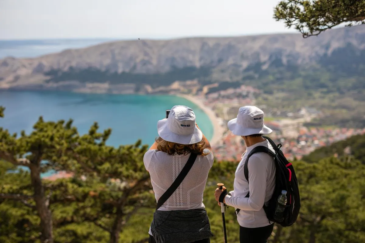
Cycling to the Moon Plateau (MTB)
A strenuous, rewarding mountain biking trail ascending from Baška to the rocky desert of the Moon Plateau, offering stunning views of Velebit and the Adriatic.
Open guidecycling No. 426
A comprehensive 39km cycling tour navigating the very core of Krk Island. This route connects multiple municipalities, blending challenging climbs with rich Glagolitic history and unforgettable coastal descents.
Designed for more experienced cyclists, this expansive 39-kilometer route utilizes the island’s existing road infrastructure to truly encircle the heart of Krk. The journey begins in the city of Krk outside the sports center, initiating an ascent along state road D102. You will ride through the island’s greenest sector, passing Lake Ponikve and stringing together the interconnected, scenic villages of Barušići, Oštrobradići, Žgombići, and Kremenići.
The route climbs to Sv. Vid – Miholjice, dominated by its late 19th-century parish church and towering bell tower. From here, the road pushes upward into the Municipality of Dobrinj. In the village of Gabonjin, history enthusiasts can explore the Glagolitic Park, a fascinating collection of stone sculptures honoring the ancient Croatian script.
Continuing through dense vegetation into the Vrbnik area and past the village of Garica, the route begins its rewarding final phase. Before rejoining the main road near Krk, you will pass one of the island’s oldest and largest trees—the legendary “koprivić” (hackberry) near the Misučajnica pond. The final descent into Krk is spectacular, offering breathtaking views of the Puntarska Draga bay, the islet of Košljun, and the village of Punat, framed by traditional dry-stone walls and olive groves.
With over 700 meters of elevation gain, this route requires good physical fitness.
The best vistas in Krk Island are far from the bus stops. Rent a car to reach the trailhead and explore at your own pace.
Rent a Car in KrkDon't lose your way on the karst plateaus. Get a local eSIM for instant data and keep your GPX maps running offline.
Get Croatia eSIMHiking alone or on remote trails? Ensure you have active travel insurance.
GPS track visualization and terrain overview.
Loading Terrain Data...
cycling
A strenuous, rewarding mountain biking trail ascending from Baška to the rocky desert of the Moon Plateau, offering stunning views of Velebit and the Adriatic.
Open guide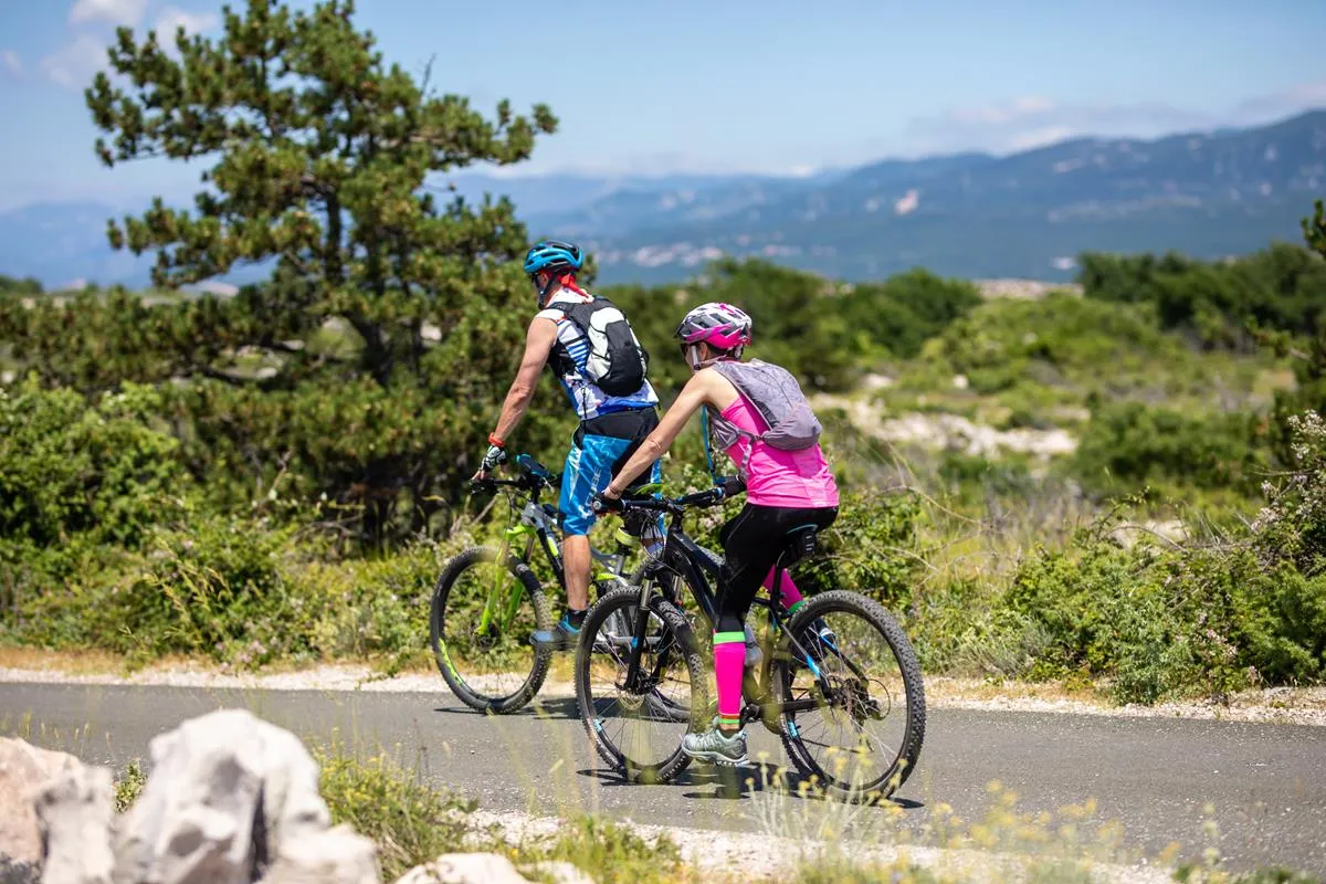
cycling
A relaxing cycling path near Omišalj, perfect for enjoying the coastal breeze and wellness activities along the shore.
Open guide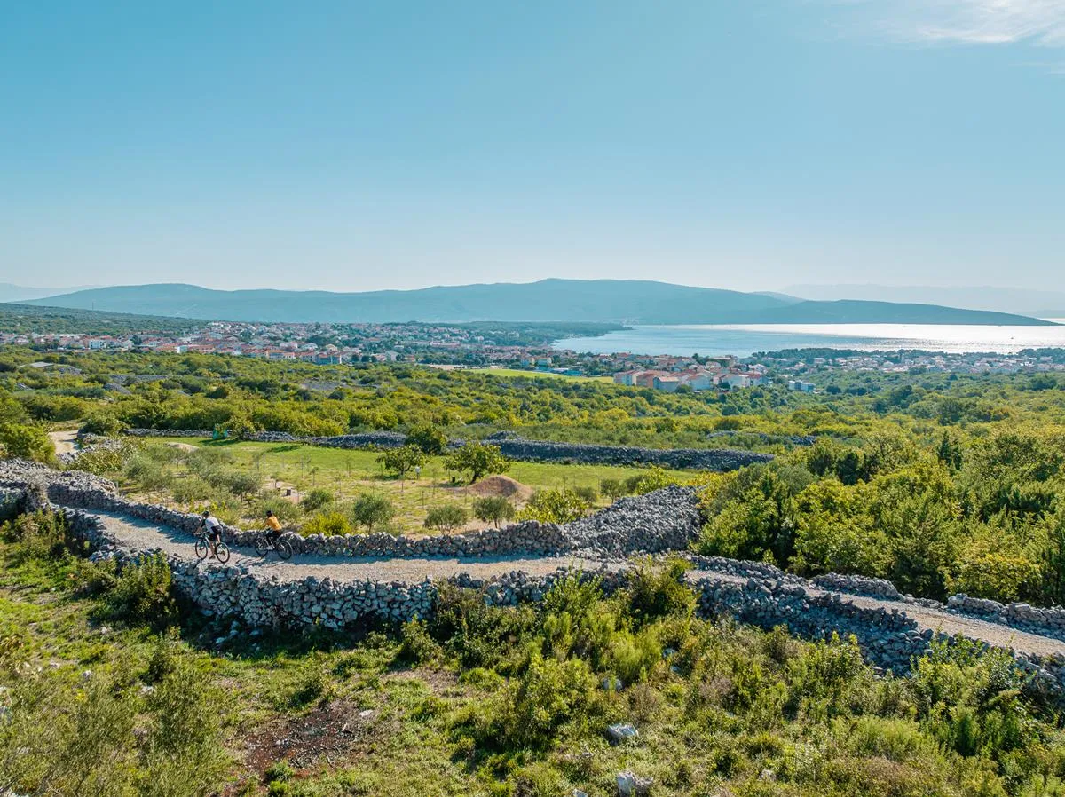
cycling
An exceptionally dynamic intermediate trail full of surprises, weaving through historic castles, agritourism estates, and Krk's culinary hotspots.
Open guide